Well from the heading of this post you can draw a quick conclusion about my success. My group was not able to finish the Traverse attempt, though we probably could have with an extra dose of motivation.
I had floated the idea of a one day Presidential Traverse to my friend Drew last year. The Traverse is probably one of the longest and most difficult hikes in the East. While there is no specific Traverse route it basically is a hike across the major Presidential summits in the White Mountains. The length varies depending on the exact route chosen. Ours was planned to be 19.6 miles with 8933 feet of climbing–in a single day. …
Many people break the hike into more than one day but a fair number also complete it in a single day. Our plan was to start early, 3:00 in the morning and hope to finish before sunset. To accomplish this task we needed some support to drive cars around. There would be six of us on the Traverse and we needed two more to shuttle cars. Ben and Christina offered to help us out. We would leave the campground at Dolly Copp, hike, then get picked up at Crawford Notch at the end of the hike. The team would consist of Tom, Drew, Eric, Scott, Taylor, and myself.
Watching the weather as the weekend approached we could see that it would be clear, but the season’s first blast of cold northern air came to visit in days preceding the hike. This left the summits in an unknown state of rime ice and snow. Yup snow in September. Not an unusual occurrence for Mt. Washington. In addition the wind and temps looked frigid, predicted 10 F windchill. Not exactly a summer hike.
As the weekend approached we had our plan all laid out, meet at Eric’s and my place, load cars, set up camp, sleep a few hours, hike, get picked up, eat a triumphant dinner in Gorham afterwards. All that went out the window starting at step one. Eight people are hard to wrangle, slight difficulties slowed our departure time from New Haven, especially when the weather caused us to have to pack some colder gear. Hartford traffic hit. Dinner in quaint bustling New England college town slowed things again. Darkness and dirt roads slowed things further. All told it took us over 6 hours to get to our campsite from New Haven. Thus our 3 am start time came that much earlier.
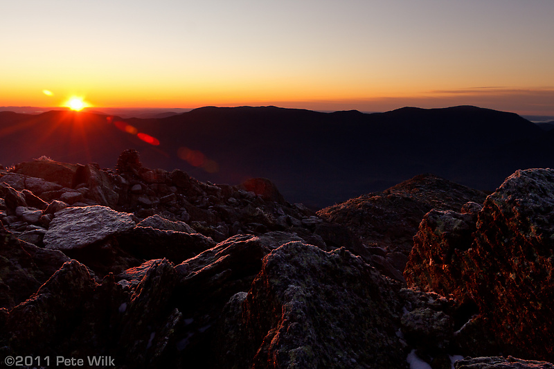
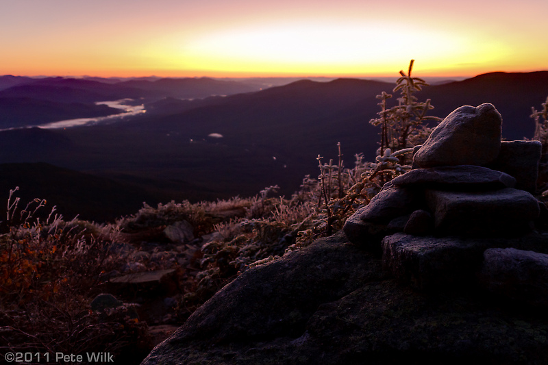 Setting off we made good time to treeline with chilly but calm conditions. Moving higher on Mt. Madison we hit frost, then rime ice which was a bit slippery. After a few hours of headlamp hiking we were greeted by a spectacular sunrise on a perfectly cloudless day. The sun turned everything pink before it popped up over the horizon. The ice and snow in on the mountains gave way to green as we looked down towards lower elevations. For a few minutes after the sun broke the horizon the mountains, ice, and snow were all a deep red-orange. An amazing experience and the highlight of the hike for me.
Pushing on we reached the summit of Mt. Madison in good spirits though the wind had reared its icy head. It was definitely not summer anymore. I, for one, could feel my thin blood draining from my hands and feet. I wasn’t quite ready for the temps after coming from 80 F days just a week earlier.
The decent from Mt. Madison to the AMC hut was a difficult one. It was much more steep than I anticipated. Hopping from rock to rock with rime ice underfoot made things that much more difficult. Once at the hut, though closed, we were able to get out of the wind a bit. There we found a group of thru hikers just starting their day. Here we met Trail Leaf, an old-timer from Maine who started at Katahdin and was hiking south with a few younger friends. They were, and as we found out us too, were SoBos or south bounders. A much more elite crowd than the NoBos (north bounders) according to Trail Leaf. Trail Leaf was the old-timer’s trail name but I would have preferred something more wizardy. He looked, acted, and sounded like a wizard. Long white beard, peculiar voice, and definitely a character. Not a Gandalf like character but more of a strange impish wizard. He almost beats out the sunrise for my fondest memory of the trip.
After a short conversation about where we were going, where we’d been we ate some breakfast then headed towards the summit of Mt. Adams. The wind returned and the sun was not warming things up enough to melt the ice and snow just yet. As a result, and because of the rugged terrain, gaining the summit of Mt. Adams was quite a bit more exhausting then I would have thought. No worries though, at this point we were about on schedule according to the book.
From Adams we quickly got down out of the wind and headed towards Edmands Col between Adams and Mt. Jefferson. The wind and temps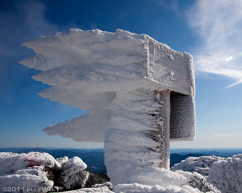 were a bit better than the last time I was here. By this time the sun was warming things up and the wind dying down. Our chilly dark day had turned into a perfect hiking day, clear, cool, and sunny.
Our pace slowed as we ascended the rock pile summit of Mt. Jefferson. The miles of rock hopping began to take their told and we rested numerous times. This is was started to undo our well laid plans. Looking at the clock and the mileage, we were about a 45 minutes behind schedule. With this in mind I got up and set off down the summit hoping to make up a little time. Just before clearing the summit pile of rocks the old-timer summited. Tom let out a little whoop. Drew followed that up with his own. The wizard thought he’d join the fun and let out his own followed by a “Now we know we’re livin’!”
We descended Jefferson in good time and took a rest before heading up Mt. Clay. We were still running behind schedule. Checking the time after a slog up to Mt. Clay and we were even more behind, at least 1.5 hours from my calculation. There was nothing left to do except push for Mt. Washington.
I was hopeful that the approach up the summit cone of Washington would be easier than the two winter summits I did this year. Turns out it is just as bad approaching from the west as it is from the east. The hike up Washington was endless slog. At least at this point the sun was melting a lot of the ice and snow. Our spirits were definitely low, probably lower than our energy levels at this point. The only motivation was that there would be a place to sit at the summit.
Right around 2 pm we arrived on the summit. During the winter there are a surprising number of people on the summit, but nothing compared to the zoo in the summer. The cog railway and auto road let any yahoo on the summit. And once they arrive they want to get their picture taken with the summit sign. The no doubt feel like they earned it with the 60 feet of elevation they made from their parking spot to the sign. I would prefer a hiker preference for photo ops and the sign. Four hikers for every one motorized tourist should be the staggering of the line. The whole place seemed like a ski resort.
Sitting down inside we talked over our options. Since we had a cell signal and learned that Ben and Christina were close by, we could split up if we wanted to. The consensus in the team was that continuing wasn’t desired. For some reason I calculated us about 2 hours behind schedule, if true that would put us finishing around 9 pm. That prospect wasn’t appealing to anyone at the time. Ultimately Tom and Drew took the Auto Road down. Scott, Taylor, Eric, and me went out on the Lion’s Head trail.
Dinner was well deserved, even in failure, for us at the Muddy Moose in North Conway. Heading back to the campsite I don’t think it took more than 10 minutes for us all to be fast asleep.
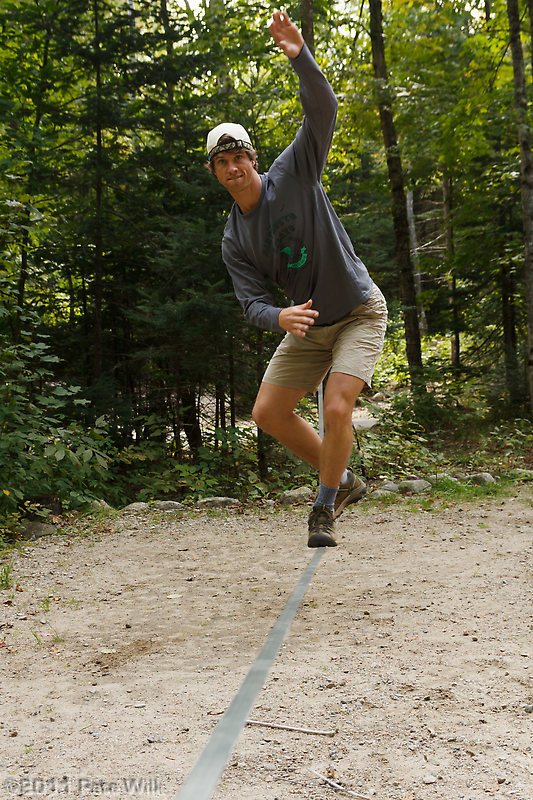 Sunday was a lazy day of making breakfast, slacklining, and tossing the frisbee around. I couldn’t have thought of a more relaxing post hike recovery day.
The trip was great fun even though we didn’t complete our objective. I think we all have a better understanding of what the hike entails and we are all interested in getting back again to complete it. On Monday looking at the elevation profile and statistics, we were so close. Yes there were 9 miles left, but only 1,300 ft of climbing. It was almost all downhill. We were very close. I think it would have just taken someone to be the cheerleader and we could have all gotten some motivation back. Maybe next time.