August 1–10, 2021
In the early days of 2020 Carly and I started planning a summer road trip to either the Pacific Northwest or to California to hit some climbing zones. When 2020 went sideways those plans got shelved for more a modest road trip to Wyoming. Coming into the spring of 2021 we got back into planning mode—at least a version of it anyway. We kept checking out places in the PNW but as the dates grew closer we made a change of plans a couple weeks out to go to California’s High Sierra instead. The main reason being that the wildfires seemed to be smoking up the PNW and northern California more than the CA central mountains.
We have had a string of bad luck with alpine objectives the last few years so we decided to try and stack the deck in our favor. Luckily we have been feeling pretty fit from an aerobic standpoint because of the trail race we did in mid-July. The next thing we did is pick some very approachable objectives. Our main targets were Crystal Crag, a 4 pitch mini alpine objective near Mammoth Lakes. Second was Cathedral Peak in Tuolumne Meadows. And third we made a call to a couple guide services to see if they had openings for Mt. Whitney. We completely lucked out on the last one as trying to book a guide and get a permit for Mt. Whitney a couple weeks away from the date is practically impossible. Despite the odds we got a spot though.
We headed west the day after our friends Courtney and Stephen’s wedding. However, before we could do that I had to make an unplanned detour to purchase and pick up a new motorcycle. That is for another post though. After picking that up and bringing it back home we then actually headed west towards Bishop, CA.
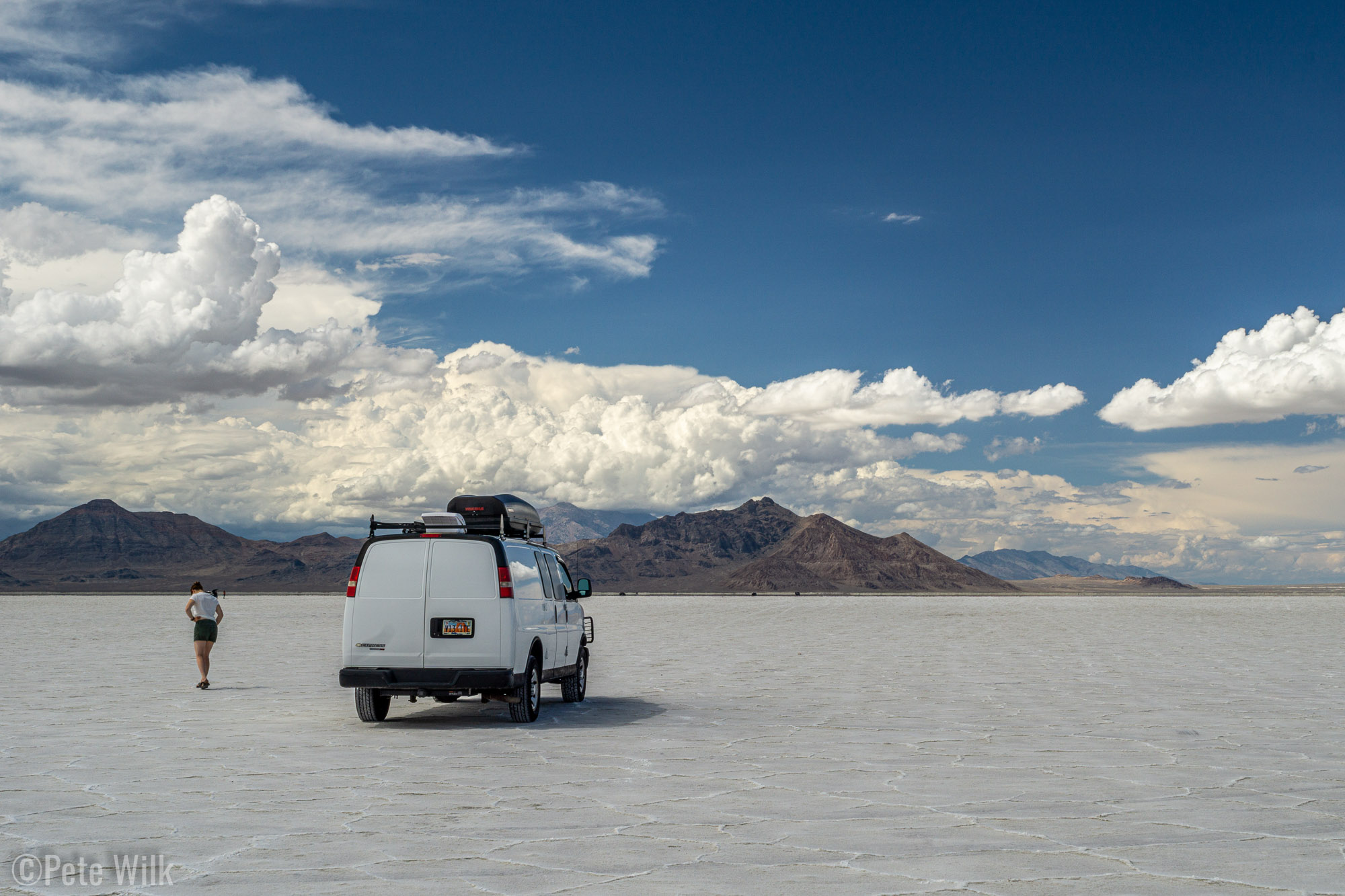
On the way west on I-80 we drive through the Great Salt Lake Desert which is home to the Salt Flats. Just before the last exit in Utah there’s a rest area and that rest area has access down to the Salt Flats with your car. We did a quick roll out on the flats to check them out. They are sort of surreal. Flat white ground as far as you can see and absolutely no plants of any kind. It is easy to see why they have a race track just a mile or two from this spot.
That evening stopped in Tonopah, NV for dinner and then got distracted by the world famous Clown Hotel when we should have gotten another tank of gas. This resulted in a somewhat stressful almost coast into Benton, CA to fill up. Unfortunately this prevented us from hitting a hotspring in the middle of nowhere for an evening soak, which probably would have been amazing with the stars—perhaps next time. We did make it to the gas station in Benton with perhaps 60 miles or so on the range to spare, however the van was already starting to give us warning to get fuel.
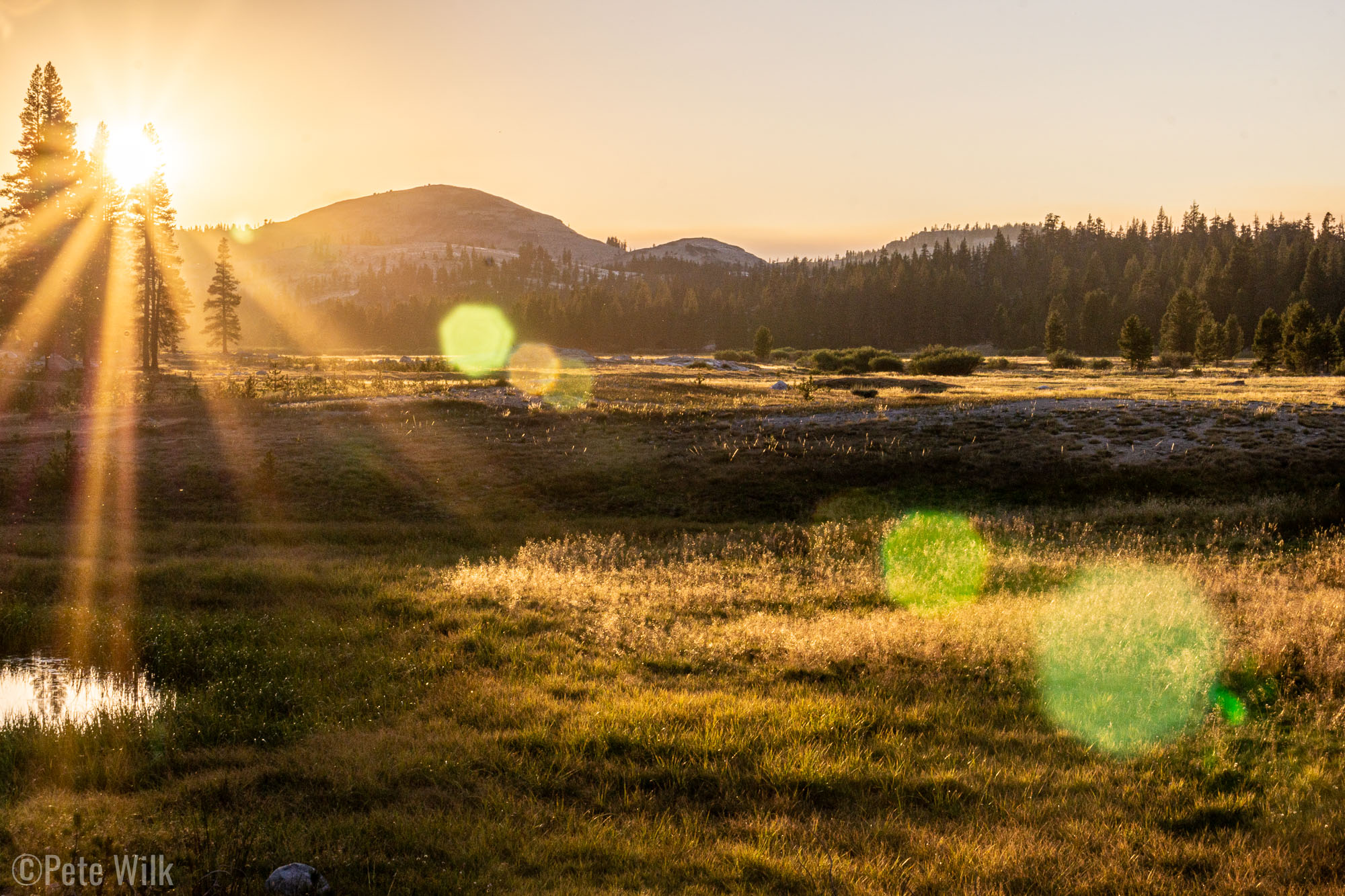
Rolling into Bishop we got breakfast at Schat’s Bakery, which is an amazing operation. After getting a few supplies in Bishop we kept rolling to the Mammoth Lakes area for the site of our first objective Crystal Crag. We did a trail run the first day since we weren’t sure how long the climb would take and figured starting in the afternoon wouldn’t be for us, though it turns out it would have been fine. The run was nice and we got to see a bunch of the area from different places and elevations. Nice landscape changes of sparse forest, to volcanic ridgelines to granite cliff to granite kitty litter slopes and then into a nice pine forest to get back to the van.
That evening we were very lucky to score a spot at one of the many busy campgrounds in the area. The spot we got wasn’t the most aesthetic but it had a nice view of Lake Mary and Crystal Crag. Our site was next to the camp host who checked us in. He was living out of his van and had a large pop-up screened in tent outside his sliding door. While checking in I noticed a cat walking around inside it. It turns out Jonah had two cats and he does let them out (individually) with supervision. Later that day we got to meet Cyrus, who was quite content to follow Jonah around without a leash. It’d be cool if Gracie was that confident in the outdoors, but she’s just a house cat.
The next morning, though not super early, we hiked up to Crystal Crag. The peak is not particularly big or magnificent, but what it does have is a massive vein of quartz running through it that intersects one of the northern summits. We headed up the North Arete or North Face (5.7) or something like that. We weren’t sure of the line we took. At about mid-height we got onto the quartz which varied from slightly rust colored to bright white. The formations in the rock are pretty interesting, much like stairs or blocks. Pulling through the last little bit it is all quartz around you and the summit block at the top of the route is a gleaming white chunk of it. Interesting rock and great views of all the lakes. It was quite clear with no sign of smoke.
Our next objective was Cathedral Peak in Tuolumne, which is the high elevation zone of Yosemite. We headed north towards Lee Vining and the eastern entrance of Yosemite NP. As we turned off the 395 to 120 we stopped for some $5.25/gal gas. Turns out CA prices and the last gas station before getting all the way down to Yosemite Valley will do that. Just after heading up the road towards Tuolumne we noticed a light up construction sign saying you need reservations to get into Yosemite. Perplexed we kept driving figuring we’d just figure it out when we got to the gate. A little while later we pulled up to the gate, which was closed for the evening. Sure enough there’s a slip of paper you take and you’re supposed to self declare you have a reservation for a campground, a guided climbing trip, hotel reservation or just a simple day reservation which is available online. Punishable by 6 months in jail or $5,000. This is completely crazy to me. I can understand some Covid restrictions, but requiring a reservation to simply drive into the park is silly. The safest place to be is in the great outdoors after all and Tuolumne isn’t a busy as other areas of other parks. As we mulled this atrocity over we kept driving to see if there were open spots at the campground (there weren’t). We opted to watch the sunset a little before turning back towards Lee Vining and Mono Lake to find a spot to bivy for the evening.
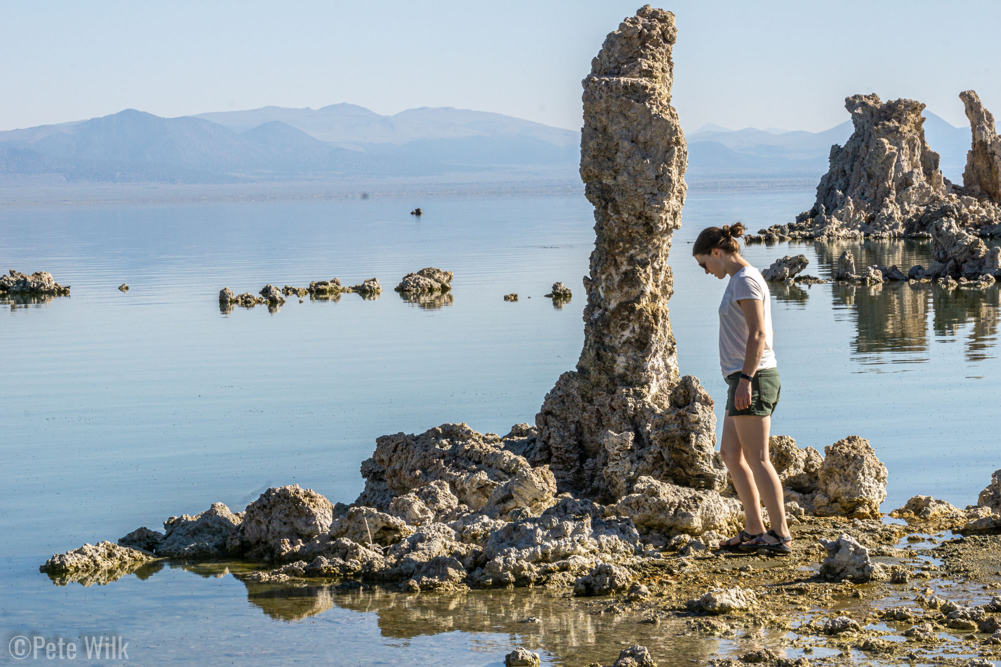
The next day we got up and tried to get a reservation which they open up online at 8:00am. We got skunked on this as well so we just did a quick tourist stop at Mono Lake for a little bit before driving south again back to Bishop. Mono lake is pretty interesting. It is a lake with no outlet like much of the basin and range topography between Salt Lake and the Sierra Nevada mountains. There are some interesting features called tufas, which are limestone deposits. They form small pillars and other blocky forms and are visible because the lake’s height has dropped over the decades because of various municipalities harvesting the freshwater entering the lake. The lake is now protected and it is being allowed to fill again to a mid-1900’s level before water can be prevented from entering it again.
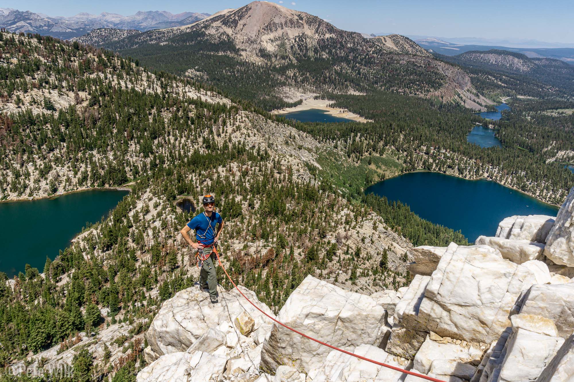
In Bishop our objective was an easy but longish climb on Mt. Emerson. We got lucky again and got a pretty nice campsite at North Lake Campground which allowed us to not need to move the van for 3 days. After we arrived and got camp set up, which really only consists of getting the van as level as we can, we did a trail run so we could get a view of Mt. Emerson. The peak has pretty complex structure from afar and so it wasn’t quite helpful to have the view other than to know we’d have to be paying attention during the climb to not get off route.
Thursday August 5th, we got up reasonably early and got started hiking in. The hike went pretty quick and we were able to get a clear view of the route. I snapped a few photos for reference once we were on the route. There were no other climbers joining us thankfully. The weather was super clear, temps were nice, the only downside to conditions were some wind.
Heading up we racked up with a 30m rope and some lightweight harnesses. I brought a couple cams and a set of nuts. Both of us opted for approach shoes since there was a lot of 3rd and 4th class terrain which would suck to do in climbing shoes. The first few hundred feet or so are the crux of the route. The face climb goes up a water drainage feature which is probably a waterfall when snow is melting above or if it is raining. Neither of these were happening for our climb. The rock was good, but a little slick in places because of the water that can be there.
After about 5 25m pitches we coiled the rope and kept hiking up. The middle section is fairly easy, but it is important to keep an eye on the large features and which way to go on the face. Once on the terrain you can’t see much other than the short view in front and therefore you lose the ability to decide well which way to go. We did get a little off route and had to rope up again for a single pitch in the middle of the face. This is probably avoidable.
Once we made it to the ridgeline we roped up again because the difficulty increased to easy 5th class but with lots of exposure and the wind really started to be more present. The ridgeline we were going up was somewhat protected on the right side, but sticking your head up over the knife edge ridge resulted in getting hit by the wind. This wind made terrain belays a little difficult at best or impossible at worst since the rope just went flying horizontally regardless what I ran it around. The climbing was super fun, never too difficult, but always interesting. Route finding on the ridge is pretty easy, it all just seems to go and if it looks hard you probably should keep looking for an easier path. We summitted and started down the notoriously heinous descent. This turned out not to be as bad as some of the reading we’d done. It all went pretty well with minimal difficulty. Even the sandy skree sections weren’t too bad. We strolled back into camp a little before dinner and cracked a few well earned beers.
Friday we’d planned as a rest day since we’d be between Mt. Emerson and hiking in with backpacking gear for our climb on Mt. Whitney. We again headed to Bishop and Schat’s Bakery. We got a few more supplies and also made sure that our hotspot was working so we could work a little on the coming Tuesday. It was pretty hot in Bishop and we were trying to figure out a stream or lake we could take a dunk in when we noticed that at the park were were hanging out in there was a public pool. We headed over there and as we walked in the high school kid at the desk asked us what we were looking for. I said, “Just looking to take a dip for a little while.” He looked at the computer and hurriedly told us “We’re closing in about 5 minutes, but if you hurry you can go in.” We were already dressed for it so we hustled in and jumped right in. The water was great and we got about 5 minutes in the pool before they blew the whistle and we needed to leave. It was just right and we didn’t have to pay.
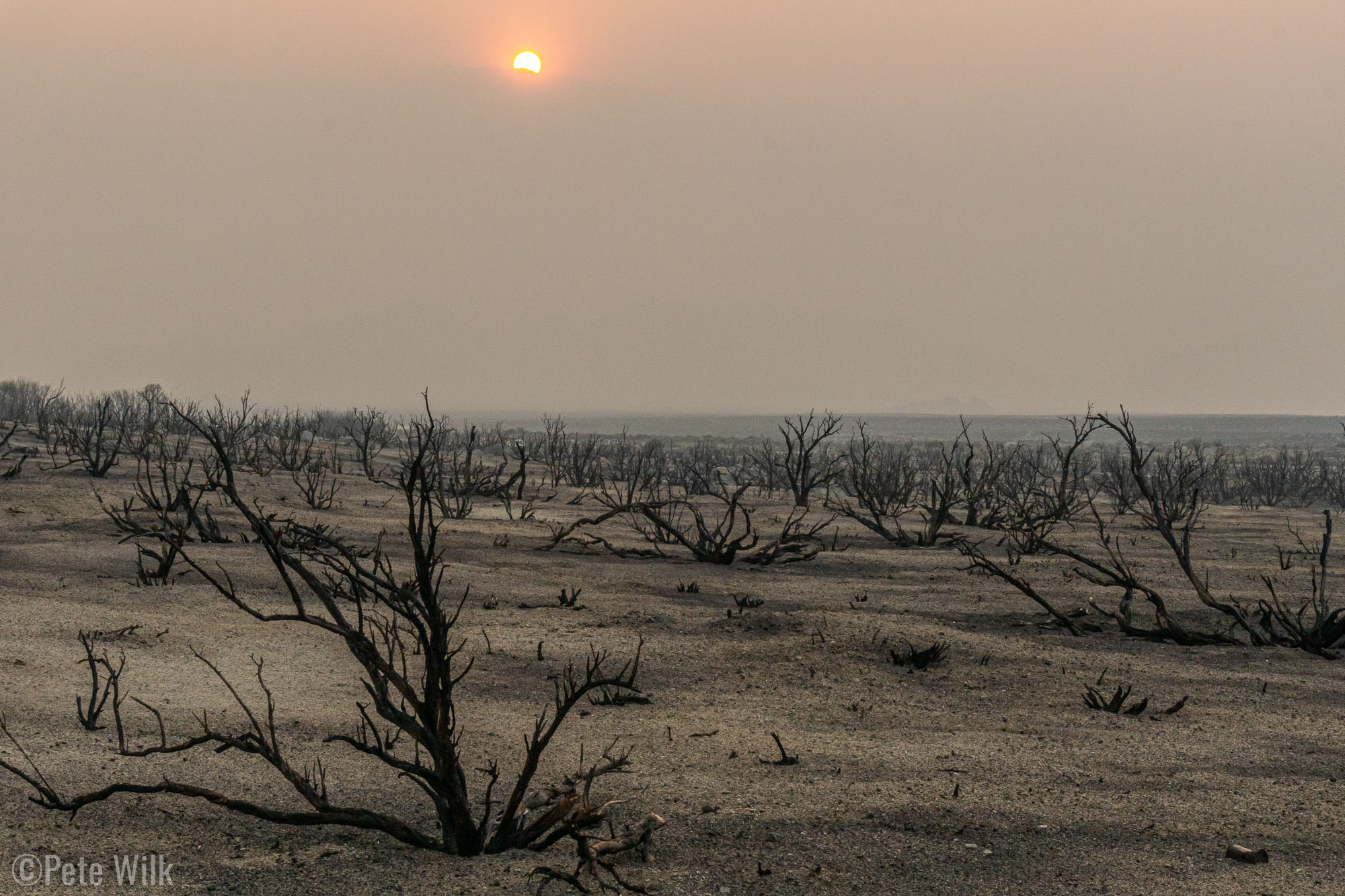
Lone Pine is about an hour south of Bishop and that was our meeting spot on Saturday with Ben our guide from Sierra Mountaineering International. Hoping to sleep at a little higher elevation we headed up passed the Alabama Hills outside of town but not quite as far as the Whitney Portal trailhead. We found a good spot to camp, well it probably was good before a wildfire went through their earlier this year. The zone was burned to just sand and black twigs sticking out of the ground. The scene was made all the more apocalyptic the next morning when due to a shift in the winds a bunch of smoke came in. The sunrise was blood red because of the smoke and made all the more heavy because of our immediate surroundings. It was something off of a movie set.
While I have climbed with guides before, both in totally casual situations and as semi-guided, I’ve not actually hired a guide before. It was a bit of a new experience, which turned out great. I expect I’ll probably go this route again for certain objectives. First a little back story. The Whitney Zone is seems like it is probably one of the more restricted places to access even for day access in the US. The process involves permit lotteries, many, many months ahead planning or fingers-crossed-wake-up-at-the-crack-of-dawn-wait-in-line-for-a-permit type stuff. Or we happened to call around to a few guide places about 10 days before our trip and we lucked into finding a place that had just had a cancellation and that group’s permit was now open as well as their guide. We jumped on it as Whitney probably was a bigger objective than we might do given our current lack of climbing fitness and our usual bad luck for alpine climbing.
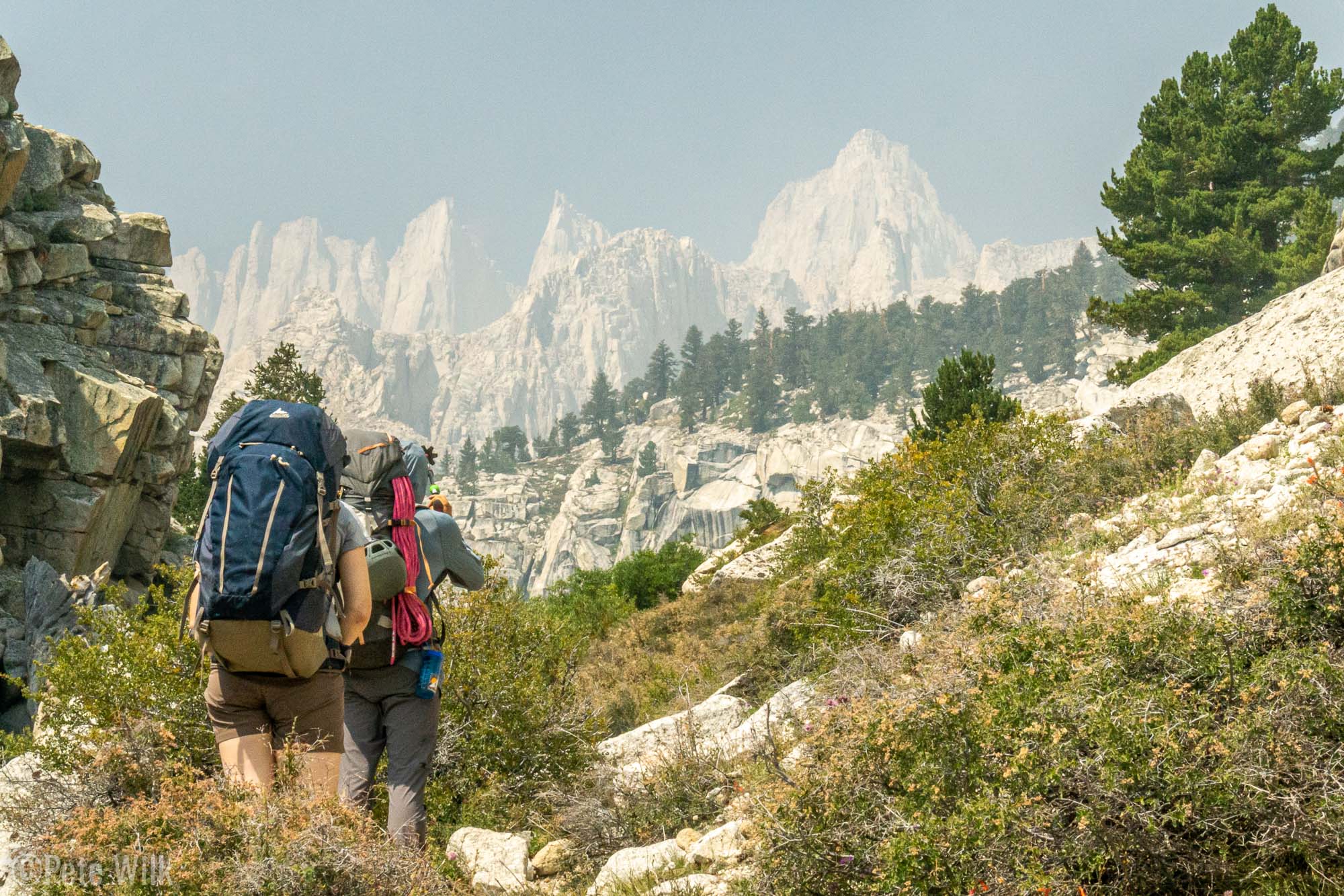
We met Ben in town after getting some pastries at the bakery he recommended (they were awesome). He confirmed a list of equipment we needed as well as passed off a few shared items for us to carry on the way up to Upper Boy Scout Lake where we’d be camping. After packing our stuff we got started up the trail from Whitney Portal Trailhead at a casual pace. There wasn’t really any need to get up to camp quickly since we’d have all afternoon to hang out. This was by far the smokiest day of our trip. It was apparent in the valley and certainly apparent as we got up out of the valley where the smoke was thicker. Even the peaks—and oh man is Mt. Whitney ever an impressive peak—where noticeably obscured by some smoke. All three of us could feel a bit of a tickle in our throats from it too.
The approach to the climbing area of Mt. Whitney is not the same as the hiking approach. The trails are the same for a short while leaving the car but then the hiking route trends left to another drainage. The climbing trail amazingly makes its way over some ledges which are very easy, though exposed. This one spot having Ben know the way was helpful since from below the trail is improbable looking. Passing Lower Boy Scout Lake I was disappointed I didn’t bring my travel fly rod. There were some nice 8-9″ trout in the stream we crossed. The landscape reminded me a little of the Tetons with the forests and alpine meadows, but it didn’t have the huge amount of wildflowers that the Tetons and the Wasatch do. Perhaps we missed them. We arrived at camp after some casual hiking and some leisurely rests in about 3 hours.
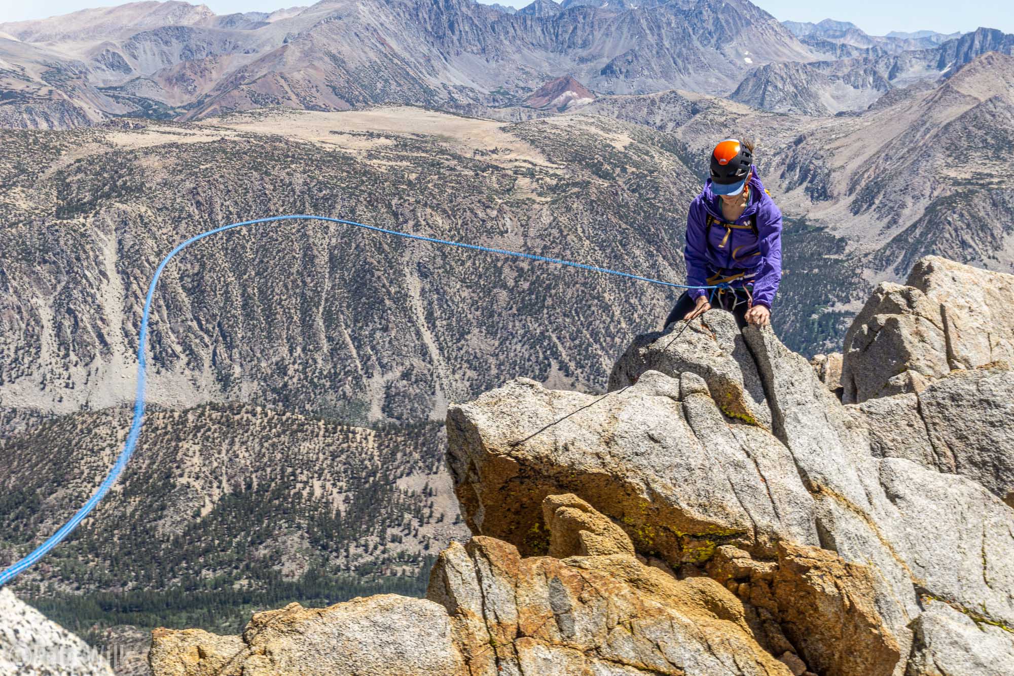
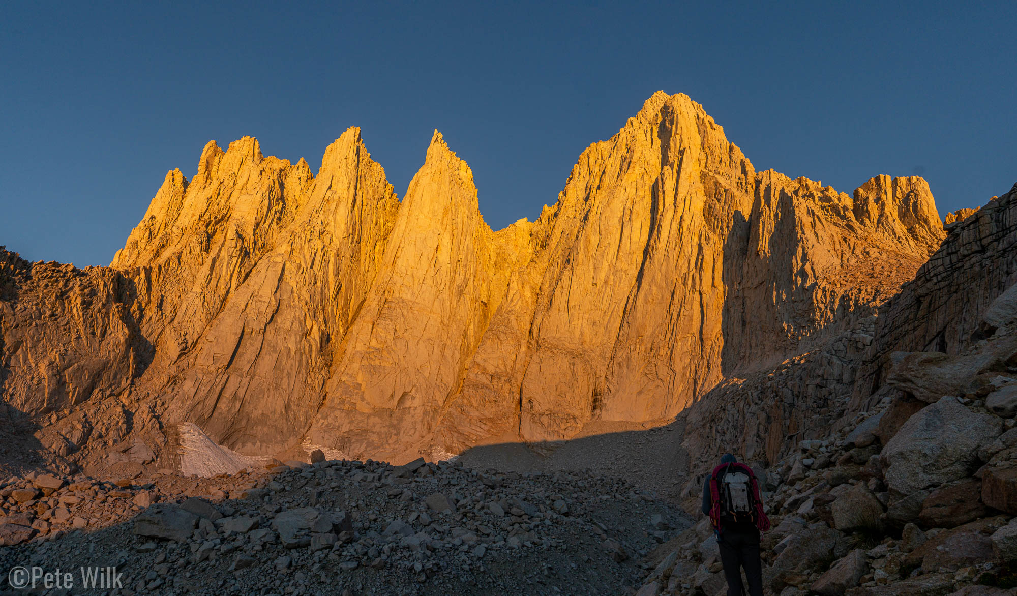
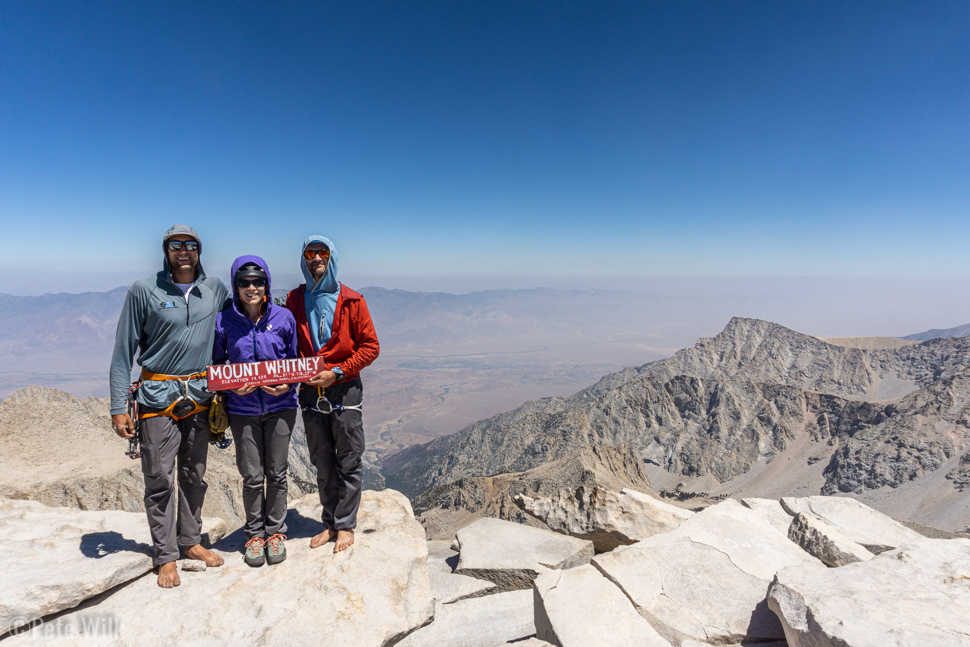
From Upper Boy Scout Lake the view of Mt. Whitney is obscured by a rocky cliff. This cliff is passed on the left and you walk all the way around the cliff to gain the base of Mt. Whitney. We chose the East Buttress (5.7). While it isn’t one of the “50 Classic Climbs of North America” it is arguably better from the reading we did. The main reason is it has more actual climbing than the East Face (5.7) route which is the 50 Classic.
We woke up at 4am to be ready to leave camp at 5am, sunrise was at 6am. Temps were reasonably pleasant overnight and the smoke seemed like it had cleared a bit. Our timing was just right since we were in full view of Mt. Whitney and the other rocky pinnacles just as the sun hit them making the early wake up well worth it. Continuing up we arrived at the base of the climb and roped up.
I felt a little bad for Ben since he needed to bring all his guide stuff which meant he had a big pack and he was leading the pitches. Carly and I had 20L packs and were probably more comfortable for climbing. The route ascends a buttress on the right side of the peak trending ever slightly left. The difficulty of the climbing felt right at the grade, sort of surprising given the route was first done in 1934. Often old climbs can be harder than their grade because back in the day they didn’t have the same possible range of grades and so sometimes things were compressed. In any case I was amazed at how high quality the rock was. There was very little loose stuff.
In the Tetons you almost always have company when you are doing a moderate classic on the weekend. For whatever reason, be it the permits, the fact it was Sunday, or the smoke, we had no one else on our route and we saw only one other party climbing the East Face while we were climbing. It was a great change of pace.
After 10-12 pitches we arrived on the summit. Luckily we’d had almost a week to acclimate, both climbing up high and almost always sleeping above 9000′. Neither of us had an altitude problems—not even the “head rush” feeling I’ve often gotten when over 10,000′ after you bend over then stand up too fast. This was great since the elevation in the lower 48 doesn’t get any higher than Mt. Whitney at 14,505′. Views from the summit were crystal clear up high, but some smoke down low in the valley. Weather was absolutely perfect, not a cloud in the sky and very little wind. It was a great summit and we saw a few people that had hiked up that day, either from the car or from one of the camping zones along the trail.
The route down back to our camp is via a route called the Mountaineer’s Route (3rd) which John Muir used to make the second ascent in 1873. This again was one of the great places to have someone who knew where they were going. There is a subtle cross over from the drainage across some slabs which isn’t obvious from the top. Missing this crossover puts you in nasty loose terrain. We arrived back in camp with plenty of daylight, but not a lot of energy. After some dinner and a wee dram of scotch we all headed to bed before the sun went down.
Monday we packed up and headed out. It was a great experience on Mt. Whitney and pretty well sets a standard for how you want an objective to go. No hangups and never having to push too hard to get the job done. We said thanks to Ben and made our way back towards Bishop since Carly needed to do some work on Tuesday, even though we’d still be on the road.
Our plan was to bivy in Tonopah where we’d work a bit on Tuesday. Since the drive from Lone Pine isn’t super far and the weather was hot we decided to kill some time and visit some high elevation area to beat the heat. The Ancient Bristlecone Pine Forest is not too far away. This forest is around 10,000′ and at the end of a windy and narrow road—I wished I had my new motorcycle. Bristlecone pines are the oldest living things on the planet, many of the trees in this area being over 4,000 years old. At first it is a little odd since the oldest trees are the ones in the least hospitable areas. The areas it prefers are those which are very rocky with dolomite and on the sunny and windy aspects. These attributes help them out compete other plants and the minimal amounts of moisture cause the trees to grow very slowly. According to one sign we read the trees can have over 100 years of tree rings in 1″.
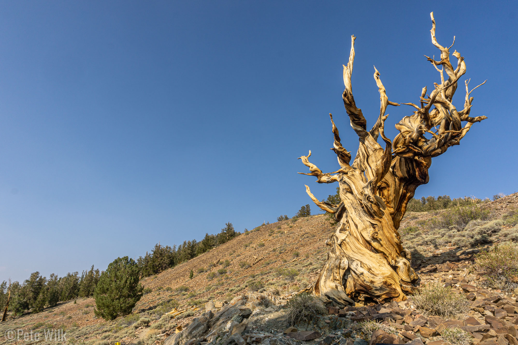
We did a short hike around one area of the forest and got to see a good number of trees. We didn’t have the energy for the longer hike where the oldest and largest trees are. Even so the ancient trees are impressive to see and remind me of Treebeard from the Lord of the Rings. It is a depressing thought that it is possible that many of these ancient trees, which have been around since about the time of the construction of the Egyptian Pyramids, may die due to climate changes in a few decades. Hopefully some of these ancients live on.
Heading back to Tonopah we bivied in town at the Star Park, which is just a spot in town that people can go check out the stars. Tuesday morning we had breakfast and then cracked open the computers for a bit. Mainly Carly worked as I hadn’t planned to work that day. I went through email and that was about it. After we tired of the restaurant’s ambiance we headed to the town library. The place is pretty small but had a nice lady working there and she welcomed us in and showed us the nice chairs they had for us to lounge in. I started reading and Carly worked a full day. From there we headed again towards Salt Lake, but didn’t quite make it and we stopped off the side of the road in no place Nevada to sleep before arriving back to SLC Wednesday morning.


.")


 of Mt. Emerson. This section wasn't all that interesting, but the beginning and end made up for it.")


.")


 lead all the pitches was kind of nice. Lots of time for pictures and such.")


. The top section of this is a little skethy for going down, hence the rope.")


